Return to home page for this artist
John Dower Britain, Australia, Working 1810-1840
Number of Works: 5, Results Page: 1
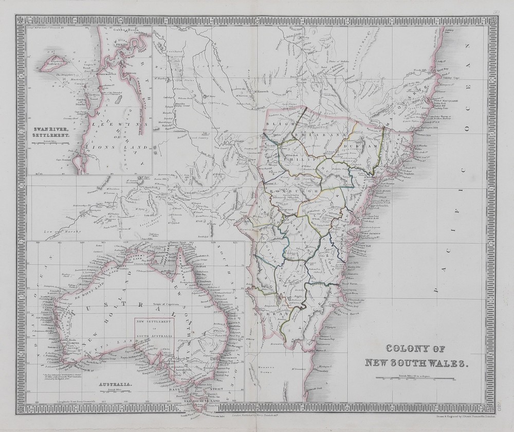
A Map Colony of New South Wales
Hand coloured engraving, inscribed on plate under image lower right [Drawn and engraved by J. Dower, Pentonville London], 33 x 41 cm (image)
Unsold

Eastern Hemisphere 1844, Map from the Atlas
Handcoloured engraving, pub. Henry Teesdaled & Co. London, 34 cm diameter
Unsold
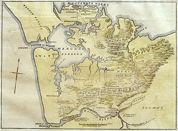
Map of the Country Between Auckland and The River Waikato, New Zealand, Illustrating The War with The Natives
Hand coloured cartographic print, 17 x 23 cm
Subscribe to see sale result

Van-Diemans Land
Copperplate engraving with original outline hand-colour, published by Henry Teesdale & Co, 1831, signed in plate in image lower left title, signed in plate below image lower right J. Dower Pentonville London, 43.2 x 36.2 cm
Subscribe to see sale result
Colony of New South Wales
Copperplate engraving with original outline hand-colour, published by Henry Teesdale & Co., 1831, signed in plate in image lower right title signed in plate below image lower right J. Dower Pentonville, London, 36 x 43.5 cm
Subscribe to see sale result